Project

Loljuh Property

Exploration activities for the Loljuh Project date back to 1969, beginning with Summit Oil Limited's geochemical and geophysical surveys. Subsequent work by Lobell Mines Ltd. in 1970 included geological mapping and soil sampling. This was followed by Maharaja Minerals Ltd. in 1973, Geostar Mining Corporation in 1987, and more recent programs by Freeport-McMoRan Mineral Properties Canada Inc. in 2019 and Carmanah Minerals Corp. in 2021. These programs included soil, rock, and stream sediment sampling, geological mapping, airborne magnetometer surveys, and helicopter-borne magnetic and radiometric surveys.

Location
Central BC, Canada
Ownership
100%
Mining Division
Omineca

Geology

The Loljuh Project lies within the Skeena arch, an uplifted northeast-trending belt of island arc affinity transecting the Stikine Terrane. The area is predominantly underlain by volcanic rocks of the Lower Jurassic Hazelton Group, especially the Telkwa Formation, consisting of andesitic volcanics intruded by the Lower Cretaceous Loljuh Stock granodiorite. The geological structure features sub-horizontal to gently northwest-dipping stratigraphy with several faults and fracture zones influencing mineralization.

There are seven known mineralized zones within the Loljuh Project, including two formal Minfile showings: the Loljuh Stock Zone and the Pete Zone. Other zones include the Skarn and Stockwork, Magnetite-Chalcopyrite Vein, Chalcopyrite-Bornite, Rudy, and Quartz-Sericite-Pyrite Knoll zones. These zones exhibit diverse mineralization styles, such as quartz-zeolite vein stockworks, skarn horizons with chalcopyrite and malachite, and copper-rich veins with significant assays reported in rock samples.

The Project is underlain predominantly by fine-grained, pale green to maroon andesitic volcanics of the Lower Jurassic Telkwa Formation which has been intruded by the Loljuh Stock of the Lower Cretaceous Bulkley Intrusive Suite.

The Loljuh stock intrudes the volcano-sedimentary rocks of the Telkwa Formation. The Loljuh stock is a medium- to coarse-grained hornblende-biotite granodiorite and is intermittently exposed over an area of ~500 x 1000 m in the centre of the Project.

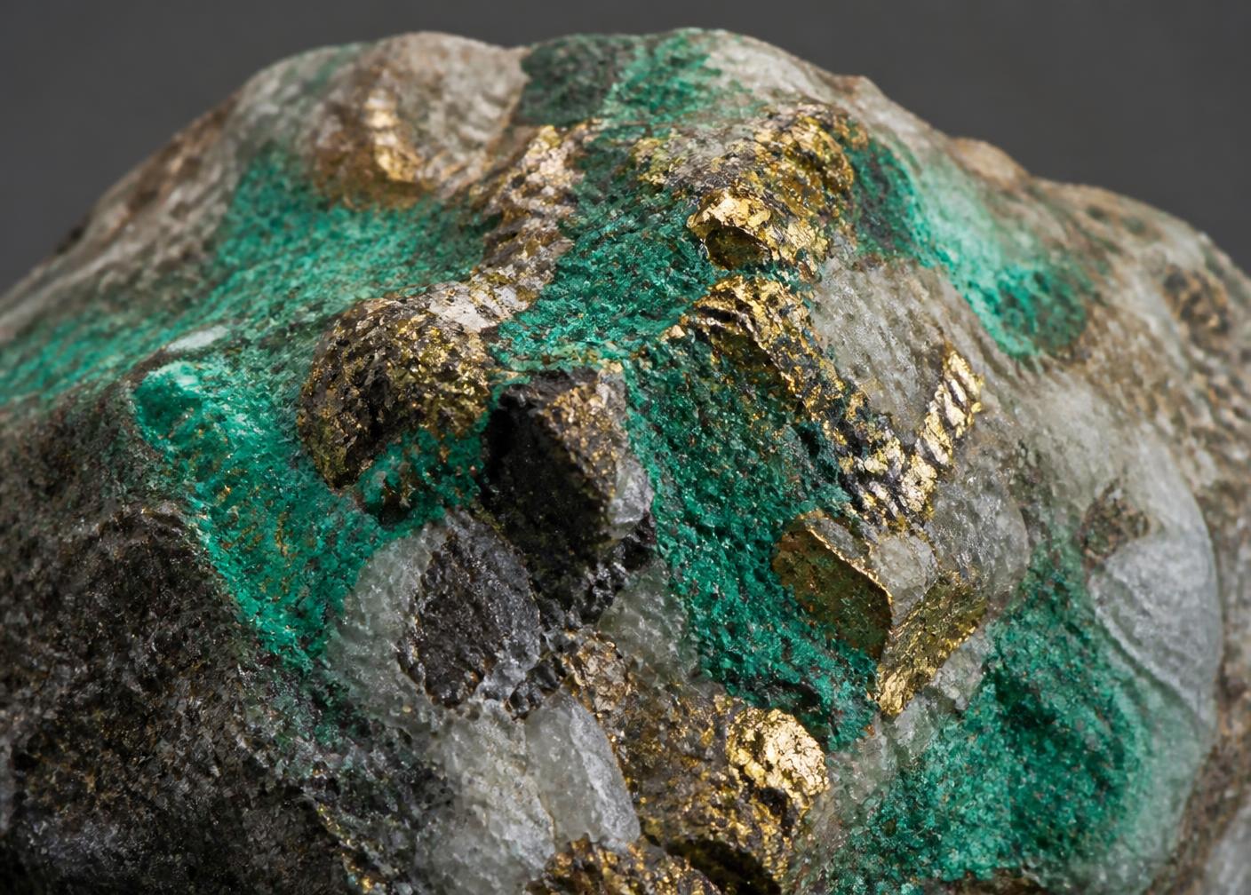
Significant veining occurs at the Loljuh Stock, the Skarn & Stockwork, and the Rudy zones. The Skarn & Stockwork Zone hosts the highest density of veins, comprising quartz-zeolite vein stockwork with minor chalcopyrite and malachite staining occurring intermittently over a 420 m length along a ridge. Adjacent andesitic volcanic wall rocks are chlorite-epidote altered.

2025 Exploration Program

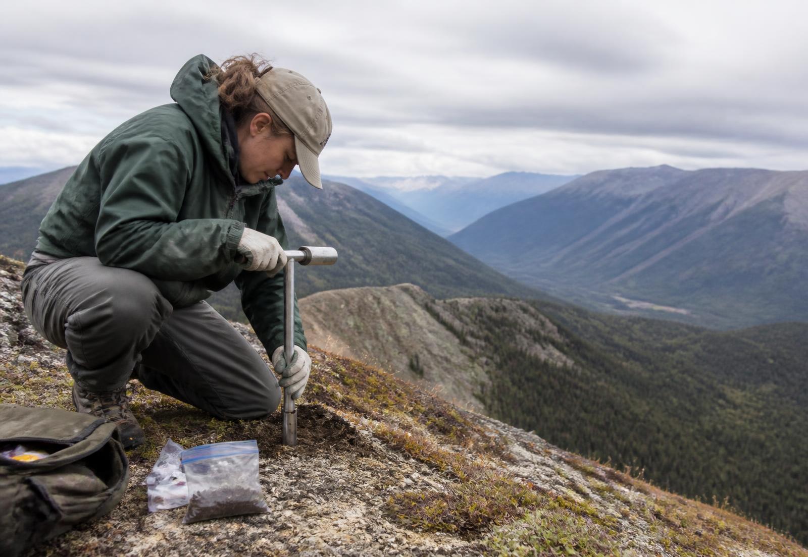
In July 2025, Bighorn Metals Corp. conducted an exploration program that involved collecting 477 soil samples, 28 rock samples, and geological mapping. The soil samples were collected on a grid with 50-meter station spacing, targeting anomalous gold, copper, silver, and zinc geochemical signatures. Mapping focused on known mineralized zones such as Bornite-Chalco, Loljuh Stock, Pete, and Skarn Stockwork zones.

The 2025 soil sampling maps illustrate there are two open ended gold anomalies, a silver anomaly is correlative with one gold anomaly, and anomalous copper and appears to have a weakly associated association anomalous god value.

Soil samples
477
Rock samples
28
Soil sampling on the Loljuh Project during the 2025 field program
Copper mineralisation with malachite staining

ACCESSIBILITY, CLIMATE, PHYSIOGRAPHY, LOCAL RESOURCES, AND INFRASTRUCTURE

The Loljuh Project lies in the Telkwa Mountain ranges on the southwestern side of Mount Forster, ~40 km south of Smithers and ~32 km west of Houston, within the Omineca Mining Division of central BC.

HISTORY

Reports detailing historical work on the Loljuh Project are few and therefore information is limited.

From what has been reported, the previous work consisted of geochemical sampling, reconnaissance geological mapping, and geophysical surveying, primarily focused around the two BC Minfile occurrences known as Loljuh Stock, and Pete. Documented work on the Project dates back at least to the late 1960’s, with the most recent assessment work being completed in 2009. In 1969, Summit Oils completed soil sampling on the Joe Claims, covering the southwestern portion of the modern day Loljuh Project. Soil samples returned 2130 ppm Cu, 17.5 ppm Ag and 635 ppm Zn.

Geoscience BC 2008

The QUEST-West airborne gravity survey was released in November 2008 as Geoscience BC Report 2008-10 extending westward from the QUEST project area. It provides high-quality data to assist in the identification of regional mineralizing controls and help the mapping of geology beneath cover and complements the existing aero magnetic data.

The helicopter-borne time-domain electromagnetic (TEM) data was also acquired over the QUEST-West area (Sattel, 2006). The survey was an Aerotem™ III system, with more than 12,900 line-km of helicopter TEM data acquired at a 4 km line spacing. Thise data complements the airborne gravity data and the existing regional aero magnetic data.

Freeport-McMoRan Mineral Properties Canada Inc. 2019

After staking the current claim, Freeport-McMoRan Mineral Properties Canada Inc. engaged the services of C.J. Greig & Associates Ltd. to undertake a project wide soil, stream sediment, rock sampling, prospecting, geological mapping, and airborne magnetometer surveying program (Mitchell & Prowse, 2019).

In 2019, a total of 61 rock samples, 169 soil samples, and 17 stream sediment samples were collected in conjunction with geological mapping in areas of thick bush to locate mineralization, identify lithologies, and characterize alteration.

Geological mapping and prospecting focused on the Loljuh Stock and Pete Minfile occurrences. Both occurrences were re-located, sampled, and mapped in detail. A 1:10,000 map was completed that outlined the Loljuh stock and determined that the Telkwa Formation volcanic and sedimentary rocks it intrudes are dominantly gently westerly-dipping.

Stream sediment sampling showed the best gold and silver results appear to be sourced from the Loljuh Stock and Quartz-Sericite-Pyrite Knoll zones. Copper has a more wide-spread distribution, with anomalous values not only sourced from the Loljuh Stock and Quartz-Sericite-Pyrite Knoll zones, but also in the region southwest of the mapped Loljuh stock, perhaps sourced from a forest covered extension of the mineralized Loljuh stock. It should be kept in mind that the best multi-element results from the combination of soil, stream sediment, and rock sampling in this program may outline an east-northeast trend encompassing the Loljuh stock, and that most of the better gold results are found in rocks north of the stock. Molybdenum anomalies are generally restricted to creeks draining the Quartz-Sericite-Pyrite Knoll Zone and the southwest part of the Loljuh stock.

The 189-line kilometre Airbourne magnetic survey outlined northeast-trending linear magnetic low features that tend to mirror to some degree the anomalous soil geochemical trends on the Project. Magnetic highs appear to be associated with mapped Telkwa volcanic rocks and the unaltered Loljuh stock, whereas a relative magnetic low is present in an area of alteration and mineralization in the Loljuh stock.

In 2019, a helicopter-borne magnetic survey was flown across the Loljuh Project at 100 m line spacing with north-south tie lines at a 1 km spacing. Several distinct linear magnetic lows were identified and interpreted as regional to Project-scale faults. A prominent magnetic high roughly correlates with the mapped location of the Loljuh stock and more magnetic components of the Telkwa Formation, an area of magnetic destruction appears to correlate with the most strongly phyllic-altered and mineralized portion of the southwest mapped Loljuh stock. The larger anomalous Cu-in-soil area outlined in 2019 correlates closely with this main magnetic high in the survey with stronger anomalous samples tending to occur on the margins next to the high. The smaller anomalous copper area occurs on the flanks of a large linear magnetic low immediately downhill from a smaller magnetic high (Mitchell, 2019).